Shoaling in Shoal Creek
October 16, 2013 | By Shoal Creek Conservancy
This blog post was written by Ted Lee Eubanks. To learn more about the author, please visit this site.
We have rain; not just a sprinkle, or a mist, or a drizzle, but a frog-throttling rain. Here are a few of the rainfall totals from this early October storm:
- Barton Creek @ Loop 360: 12.17″
- Lakeway: 6.4″
- Camp Mabry: 4.47″
- ABIA: 3.73″
The Shoal Creek watershed missed the heaviest rain. Barton Creek flooded; Shoal Creek stayed within its banks. If Shoal Creek had received Barton’s foot, we would have flooded as well. Shoal Creek does not have an unlimited capacity to carry stormwater to Lady Bird Lake.
These rains have shown us, however, precisely where and how water flow is restricted within the creek. Shoal Creek has limited capacity. When there is more water trying to flow to Lady Bird Lake than the creek can handle, there is only place for the excess to go. Up.
Shoal Creek is well named. There are shoals within the stream bed its entire length. A shoal is a sandbank or gravelbar that forms within the creek. Water transports sediment that collects in and around any obstacle (a tree, a rock, a bridge). The high velocity and volume of storm water are capable of transporting larger stones and boulders.
Shoaling is obvious around most of the Shoal Creek bridges. The shoals restrict the water flow and force the creek into a narrow channel. The sediments also limit the amount of water that can be transported by the creek.
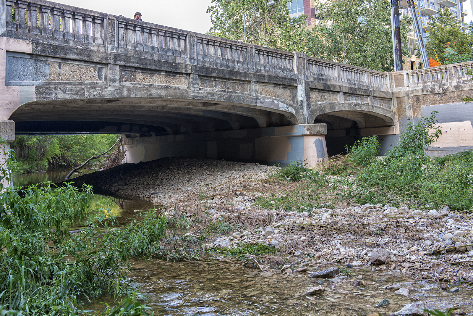
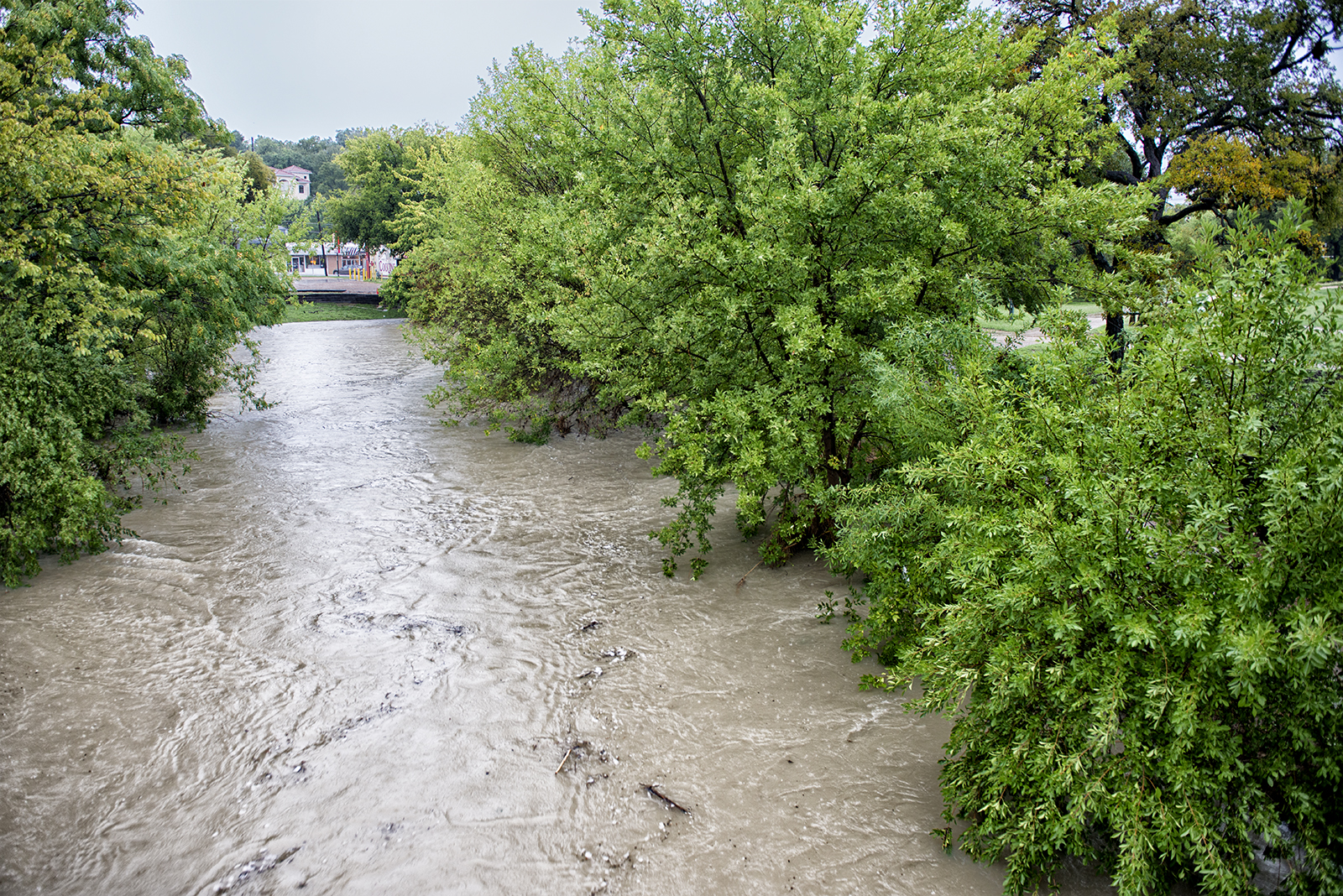
The image above is of the 1931 West 5th Street Bridge over Shoal Creek. Notice the extensive shoaling under and below the bridge, and how the shoals force the creek into a narrow channel. Vegetation is becoming rooted on the gravelbar, and the emerging shrubs and trees will trap sediments and exacerbate the gravelbar’s growth.
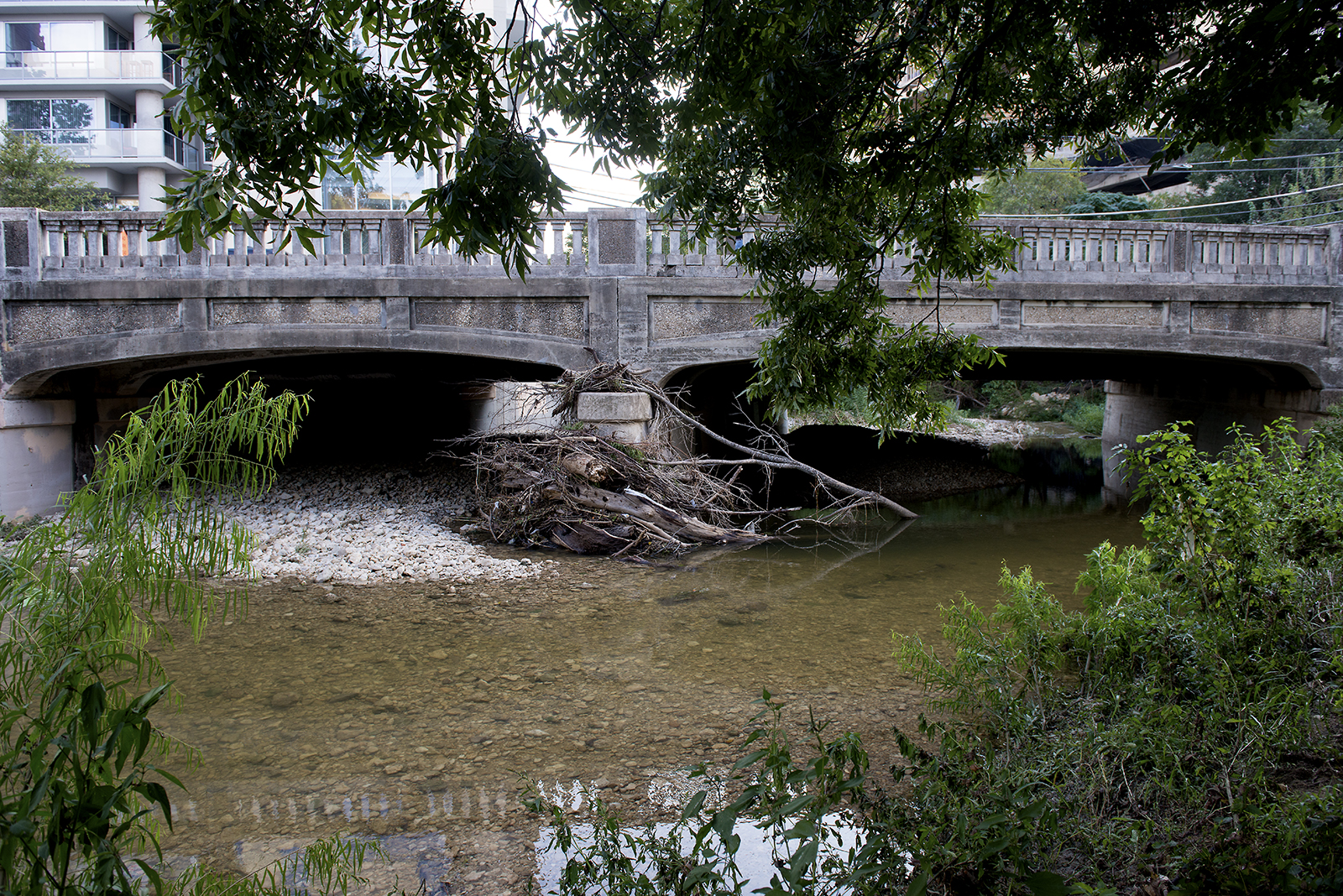
This next image shows the north side of the 1931 West 5th Street Bridge. The shoaling is obvious from this perspective. Also note the debris that is collecting in front of the parapet. This debris restricts water and collects additional sediment.
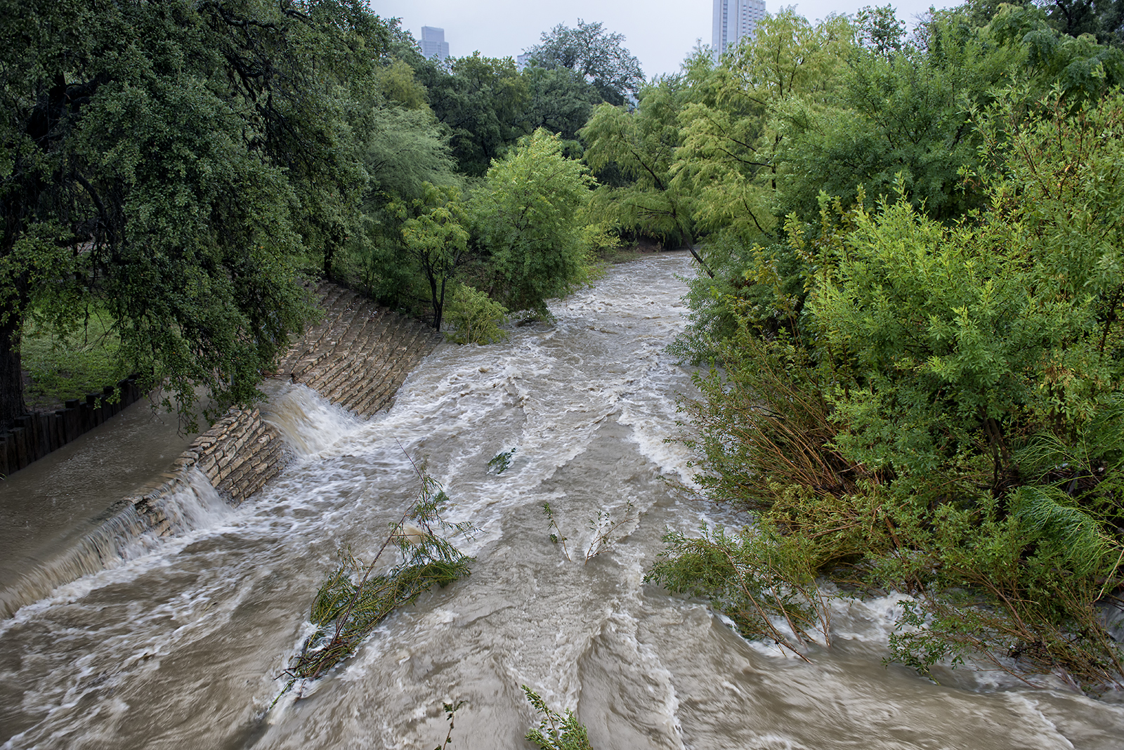
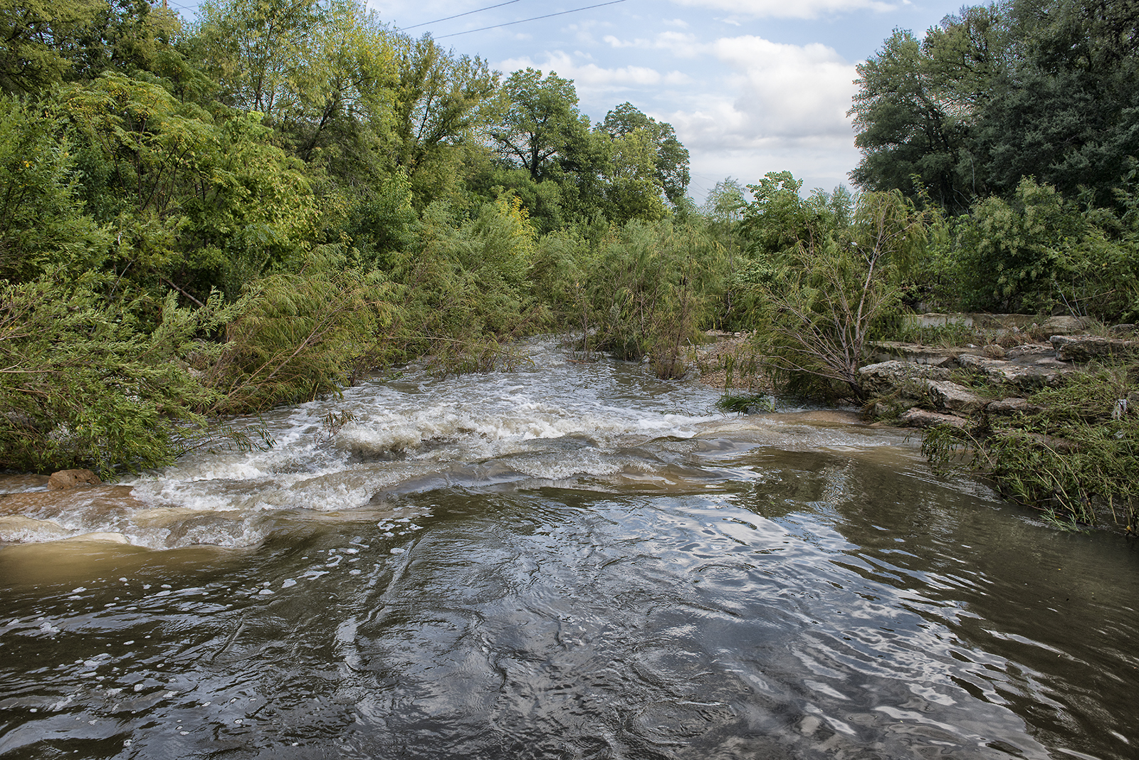
Here is another example of shoaling in Shoal Creek. This is below the 1976 West 9th Street Bridge. The extensive shoaling in this area restricts water flows and promotes the growth of in-stream vegetation. In addition, the bridge itself constricts the flow of water. Notice how the water is forced out of the creek only to rejoin via the stone bank and sidewalk.
Here is another view of Shoal Creek from the 1976 West 9th Street Bridge, looking north. The Shoal Creek Saloon is the building directly ahead. Notice how the obstructions at and below West 9th restrict the flow of stormwater and pool it above the bridge.
Obstructions and constrictions may be found the entire length of Shoal Creek. Not all of these are detrimental. In fact, those low-level obstructions that easily overflow allow water to pool and infiltrate days and weeks after the rain event. This is the crossover near the Janet Fish Bridge. Hikers and bikers originally crossed the creek on these boulders. Now they help retain stormwater.
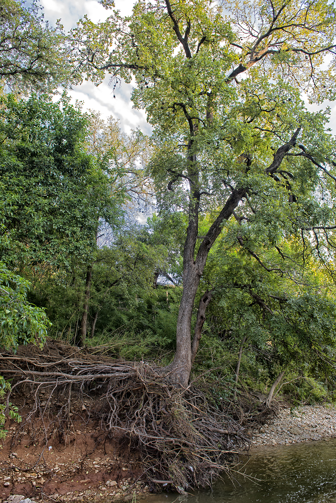
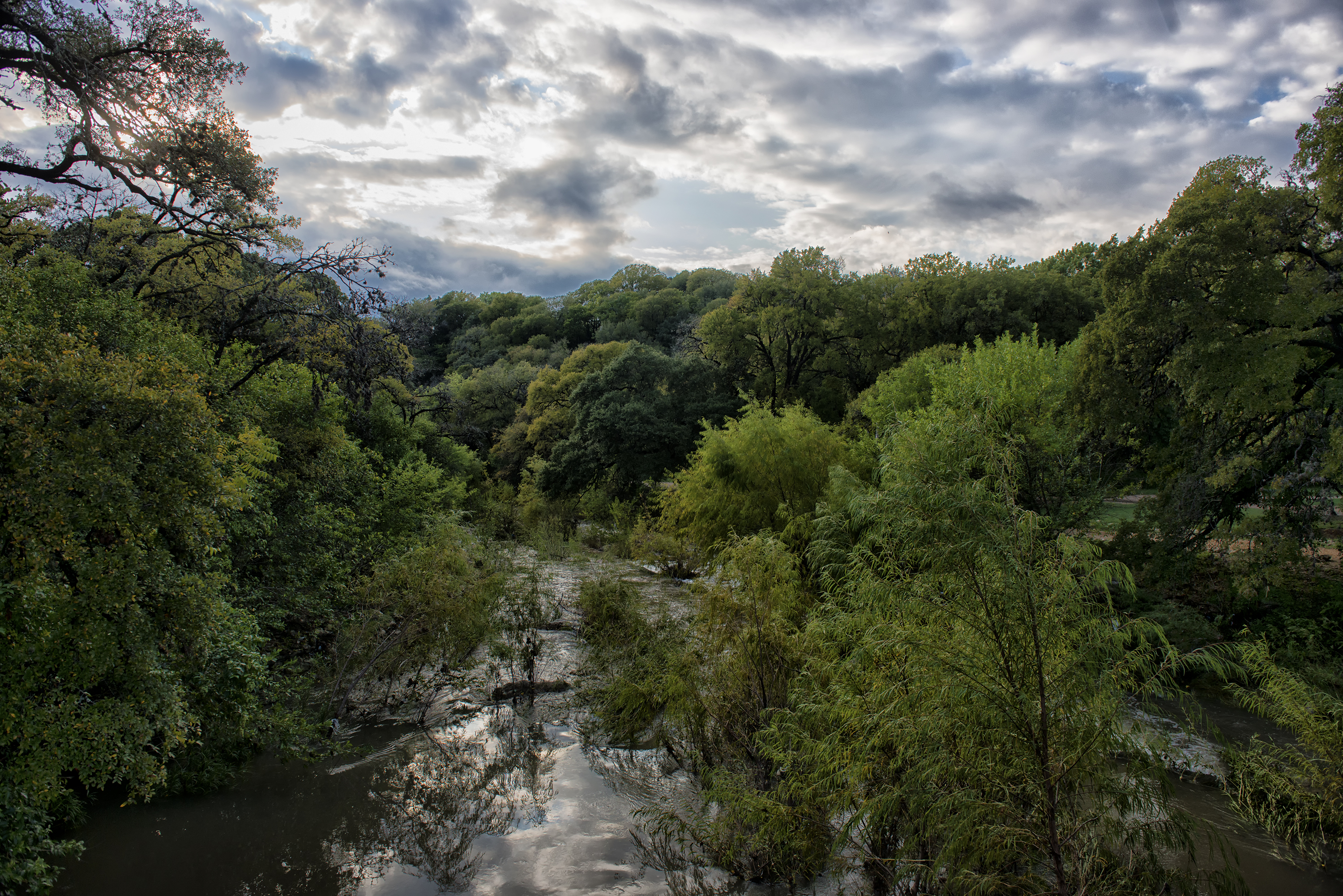
Shoal Creek is a natural stream, and many of the obstructions (such as the shoals) are integral to the character and nature of the stream. The volume and velocity of the stormwater in the creek, however, is decidedly unnatural. Development within the entire watershed, particularly upstream, has vastly increased both the volume of water coming to the creek, and the velocity of that water as it courses to Lady Bird Lake. This cedar elm is evidence of the force of that water. Once rooted in the bank back from the creek, this elm is about to become part of the creek. Erosion has undercut the bank and is about to topple the tree. Accelerated erosion of the creek banks is directly related to the volume and velocity of the stormwater the creek is now being asked to carry.
The Shoal Creek Conservancy advocates for creative stormwater management in Austin and Shoal Creek. Without using every tool at our disposal to diminish peak stormwater flows through detention and retention, and to eliminate the unnatural features that restrict and redirect flows, the continued development along Shoal Creek will only exacerbate the problem. Join with us in advocating for the implementation of the best stormwater management practices available today in the Shoal Creek watershed.

